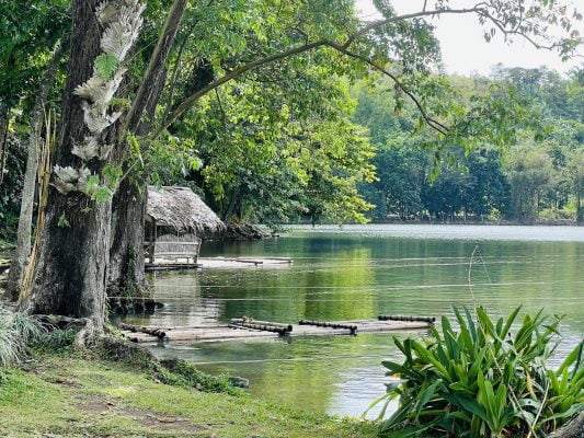
Albay is a beautiful province located in the Bicol Region, known to the world as the home of Mt. Mayon, the volcano with a perfect shape of a cone. It is a relatively unspoiled region in south Luzon, with many natural wonders including beaches, springs, caves and waterfalls. Albay offers almost endless discoveries, especially for the nature-loving traveler.
Best Attractions
The province is one of the smallest in the Philippines but its size has never stopped it from offering ultimate adventures for its visitors. Its major city, Legazpi, lies in the foothills of the majestic Mayon Volcano. Whether it is in its active or dormant state, the volcano’s beauty is breathtaking, even comparable to that of Japan’s Mount Fuji.
Albay is also surrounded by other provinces that lure in thousands of local and foreign visitors. To its north is Camarines Sur, an emerging destination for avid fans of wakeboarding. CamSur is also known for its pristine beaches. And to its south is Sorsogon, a province made famous by Donsol, where gentle whale sharks (locally known as butanding) can be seen swimming very close to the surface.
A lot of tourists find their way to the province if only to behold the majesty of the Mayon Volcano and perhaps take postcard-worthy photos of it from the Cagsawa Ruins in the municipality of Daraga. Once a Franciscan Church, the ruin is a result of the Mayon’s eruption in 1814. It is now the focal point of the park that stands as a warning of the dangers of living close to an active volcano.
Magayon Festival
Just like most Filipinos, the people of Albay are fond of merrymaking and celebrations. One of the best times to experience this distinct Filipino trait is during the Magayon Festival in May. Marked by trade fairs, cultural events and parades, the festival revolves around the folklore about the origin of the Mayon Volcano. Legend has it that the mountain used to be the grave of the lady Daragang Mayon and the clouds kissing its peak are the spirit of her lover Pangarnoron. This cultural festival is held annually in the month of May.
Spice Capital of the Philippines
When it comes to food, Albay and the whole Bicol region does not disappoint. Bicol Express, the famous ultra-spicy stew made from pork, garlic, onion, shrimp paste, coconut milk and long chilies is easily the best dish that Bicolanos are known for. The whole region is famous for their spicy cuisine, with other specialties including kinunot (sting ray meat in coconut milk and spices) and their own version of longganiza (sausage).
If you watched the Bicol Express video above, there are just a few more steps to complete this delicious recipe. Once the coconut milk thicken, stir in chopped peppers. Stir constantly until the coconut milk is reduced and the mixture is quite thick. This recipe is pretty easy but it does take quite a while to cook and requires a lot of stirring. Of course, you will find the flavorful meal is well worth the effort.
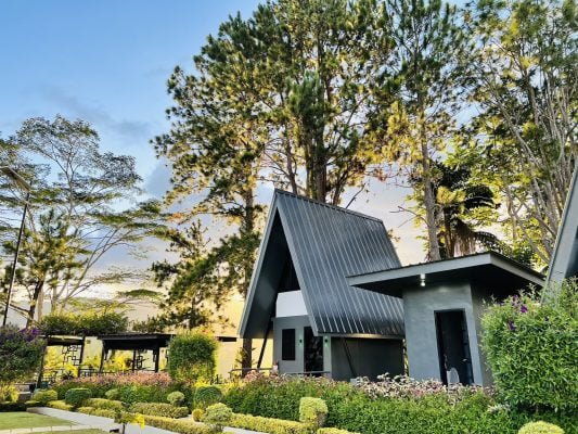
Albay is not one of the most visited provinces in the Philippines but it definitely has very interesting places, food, festivals and resorts to offer its visitors. Its rustic beauty, small-town ambience and breathtaking backdrops are perfect for the traveler looking for a respite from the hustle and bustle of city living.
Traveling to Albay Philippines? Click here for Travel Agencies